Far from almost everything, yet intimately close to raw and untamed scenery: this is how the stunning Zavial Beach Trail will make you feel in springtime. It’s a demanding trek, but one that richly rewards the most eager and adventurous hikers.
TRAIL FACTSHEET
- Location: Coastline between Zavial Beach and Martinhal Beach | Raposeira, Vila do Bispo.
- GPS: 37.04797931029627, -8.872292232156923 (Zavial); 37.0205489948135, -8.925654768049228 (Martinhal).
- Grade: Difficult. Many stretches will challenge elderly or very young visitors.
- Type: Linear trail (out and back). Signs mark this trail.
- Length: 9.000 meters / 5.6 miles (one way).
- Average Completion Time: Up to 6-10 hours (out & back).
- Best Time to Visit: All year round, except in very hot weather. We do not advise hiking on stormy or very windy days.
- Activities: Nature walks and hikes; birdwatching; surfing, kayaking, snorkeling, and swimming in summer.
[Note: To get straight to the hiking advice, skip this section.]
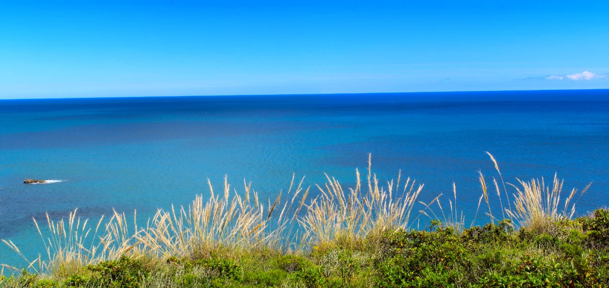
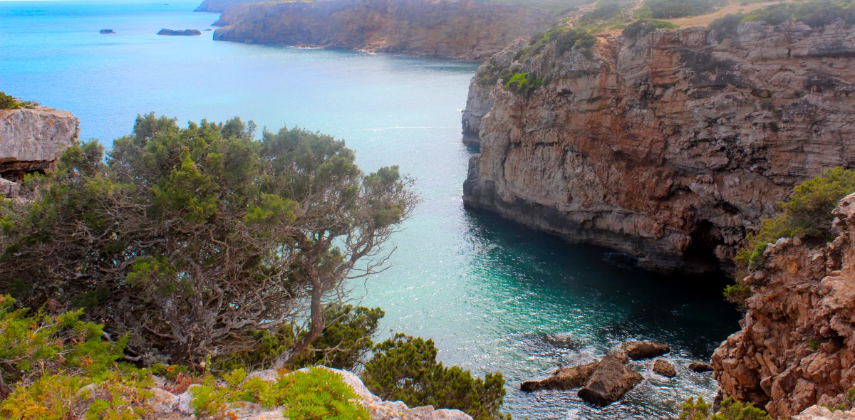
Here, the deep blue of the Atlantic contrasts vividly with the vibrant green of the shrubby vegetation crowning the jagged cliffs—a lushness that recedes in summer as plants wilt under the weight of the sun. Yet, through every seasonal hue, the experience of this hike endures: with the stark beauty of the landmass at your back, the ocean horizon stretches before you, both inspiring and refreshing.
It is one of the finest coastal trails in the Algarve. It is also an enticing section of the renowned Fishermen’s Trail. In the heart of spring, this trek is nothing short of epic.
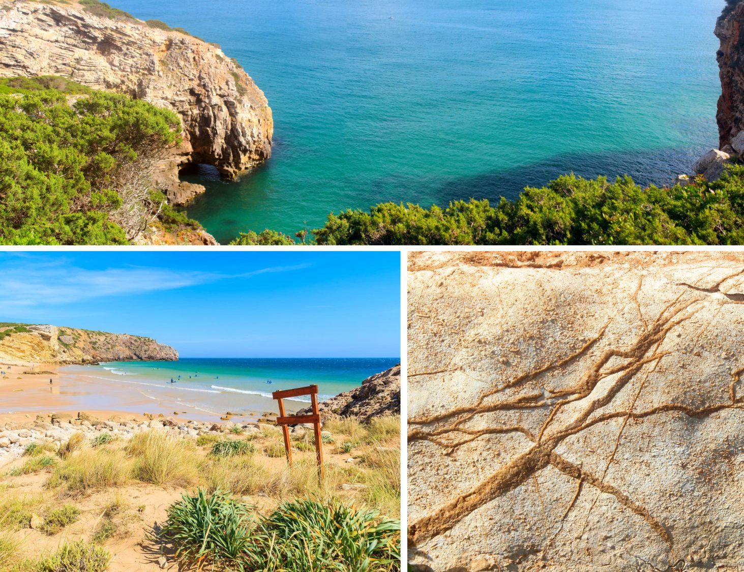
Nestled in a relatively undiscovered stretch of Algarve’s coastline, the rugged footpath offers truly captivating vistas along its entire length. Moreover, it unveils four beaches graced with some of the purest, most crystalline waters in the region. Depending on your starting point, the first of these treasured spots is Zavial Beach itself.
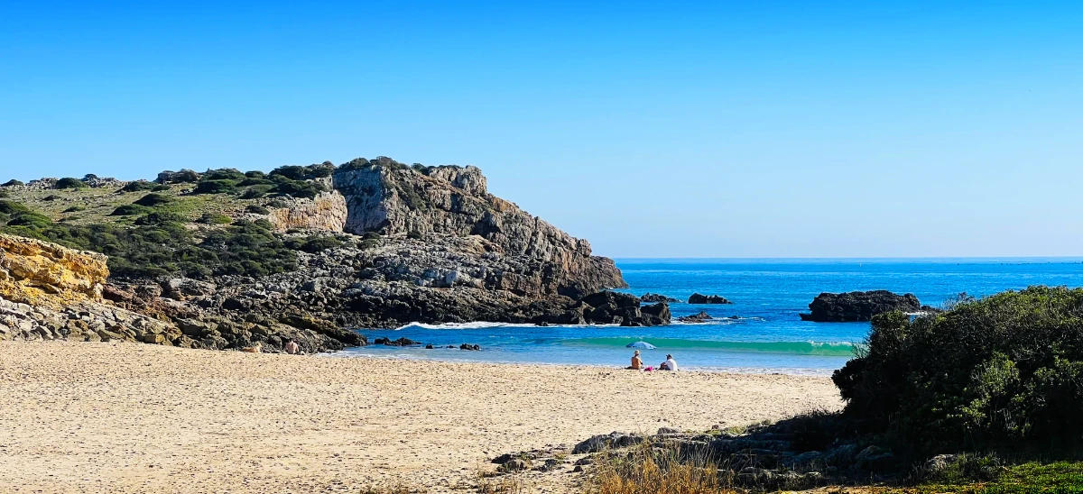
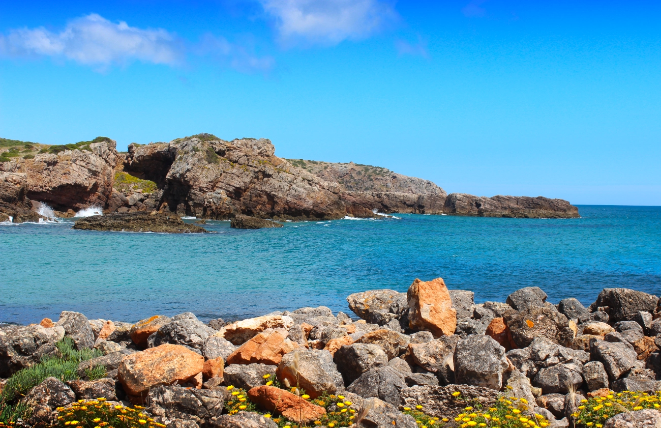
Zavial Beach | Where Waves Dance and Nature Embraces
Shown above, Zavial energizes visitors with its dual identity: a vibrant hub for surf enthusiasts that simultaneously cradles a deep connection to its natural surroundings. With its powerful, consistent waves and quaint scenery, this beach offers a lively yet relaxed atmosphere that makes it a haven for surfers and nature lovers.
The trail commences at the foot of the cliff, and its beginning is easily found (please check the map below). What proves challenging, however, is the initial ascent. Prepare for a very steep incline, an uneven surface, and the treachery of loose rocks. Yet, your efforts are swiftly rewarded with the commanding views that unfurl once you reach the clifftop.
Following this exertion, a much longer and more gradual descent guides the pathway to a site that once cradled a small fort. Today, only evocative ruins remain. Erected in the 17th century to shield fishing vessels from marauding pirates, this small bastion (Bateria do Zavial) was utterly devastated by the colossal earthquake and subsequent tsunami that convulsed Portugal in 1755.
The most intense ever recorded in European history, this cataclysm is a primary reason why the Algarve’s coastline remains so devoid of historical edifices even now. However, as some sort of recompense, we are now graced with places like the next beach on our journey: Praia da Ingrina.
Ingrina Beach | A Cove of Calm for Sun-Kissed Souls
Ingrina is a small, shell-shaped cove. A contrast to Zavial, its gentle waves make it one of the Vicentine Coast’s best swimming beaches – and an ideal spot for a hiking break on hot days. The trail skirts this beach before entering an area with unique native plants, like Camphor Thyme, Vicentine Germander, and Yellow Sea Aster (shown below, courtesy of Flora-On).
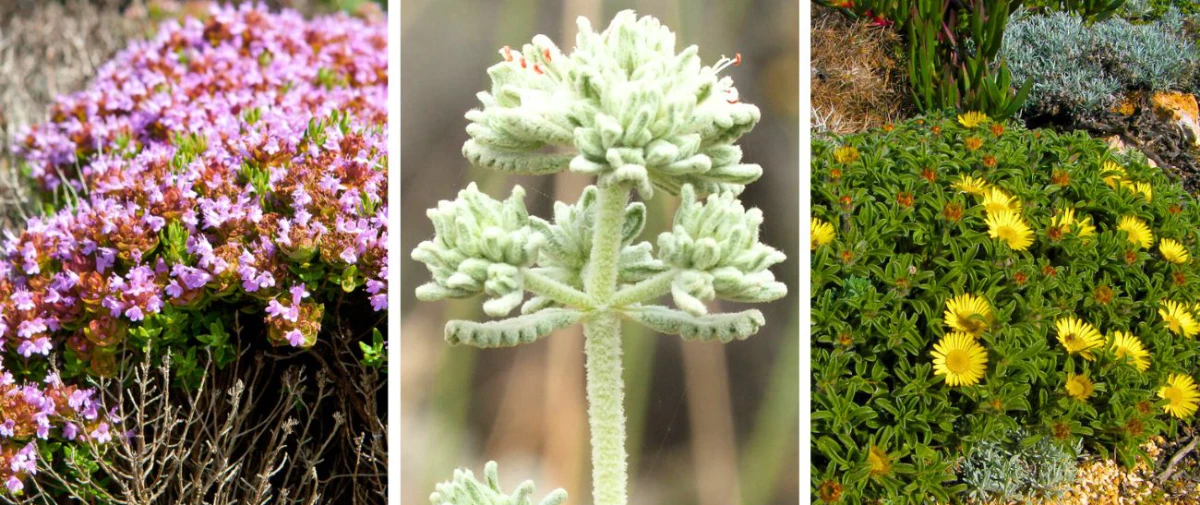
Protected by gnarly Junipers, these resilient plants thrive on the acidic, skeletal soils created by ancient shale rocks from the Paleozoic Era. On limestone and other rocks, these species are often escorted by fragrant Lavender, Rosemary and Honeysuckle.
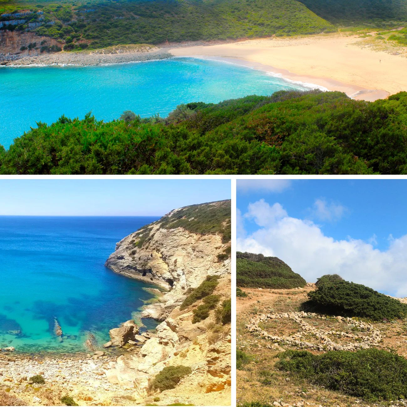
The trail then rises slowly and steadily as it uncovers primeval vistas marked by impressive cliffs and narrow, snaking bays. At the highest point, you’ll then set your eyes on one of the most remote beaches in the Algarve.
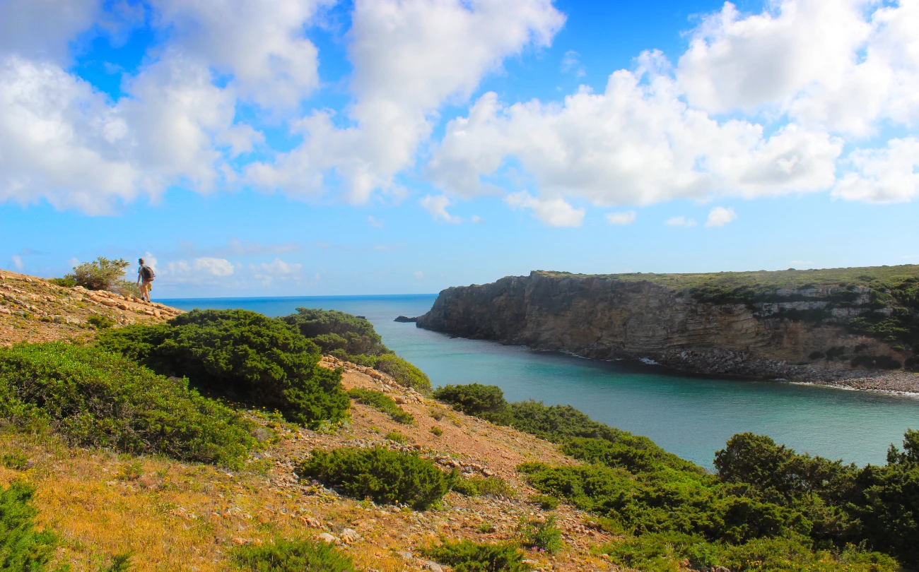
Praia do Barranco | Probably, Algarve’s Wildest Beach
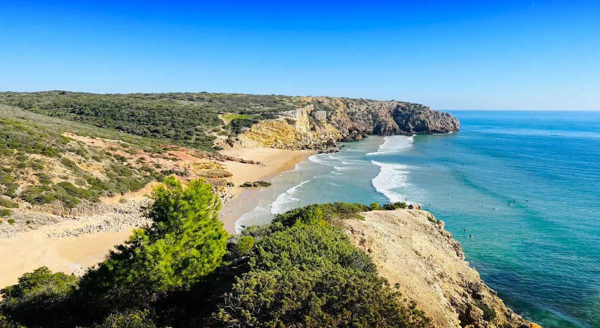
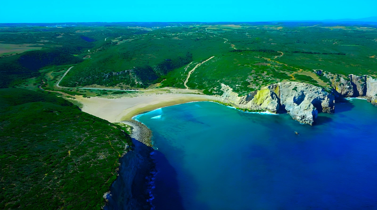
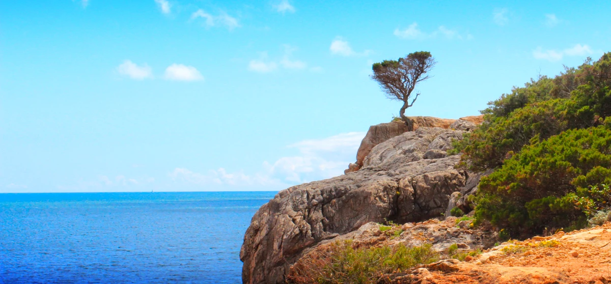
There are several beaches in the Algarve bearing the same name. All are a bit hidden and wild. However, this one is the wildest of the bunch. For the adventurer or nature purist craving truly untamed surroundings, Praia do Barranco offers a remote, welcoming escape. Nestled within a valley, the beach is dramatically framed by protective cliffs and verdant hills on either side (image above).
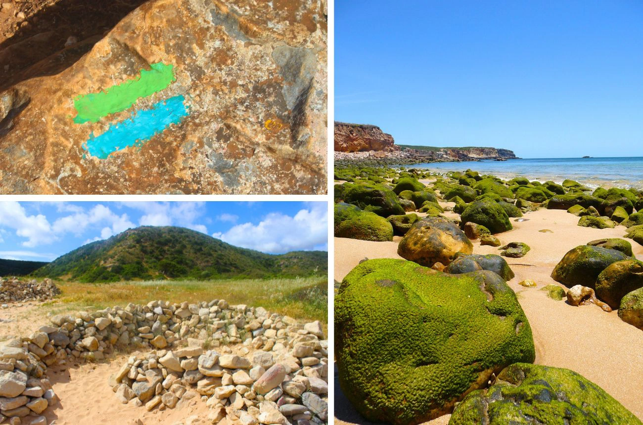
Reaching its pristine sands requires navigating a steep and slippery descent. Down on the beach, you’ll spot several circular structures built from loose stones – simple, rustic shelters used by local fishermen to find refuge on windy days.
Martinhal Beach | A Fitting Finale for Your Journey
Continuing along the Fishermen’s Trail, the next stretch immediately tests your mettle as you climb your way out of Barranco. The path ventures inland for a sun-drenched traverse across open heathland, offering a quieter interlude before the ocean calls again. The rocky cove of Praia dos Rebolinhos soon heralds your approach to Praia do Martinhal, a beach where broad sands offer a fitting reception.
Martinhal signals your journey’s end. Beyond its scenic appeal, this beach is home to important Roman ruins from the 3rd to 5th centuries AD, notably featuring kilns once used to produce amphorae. This ancient pottery centre, once dedicated to crafting vessels for sea commerce, strongly reinforces the trail’s enduring connection to the maritime world. You are now in the Sagres Peninsula. And you have reached Europe’s dramatic southwestern farewell. Enjoy!
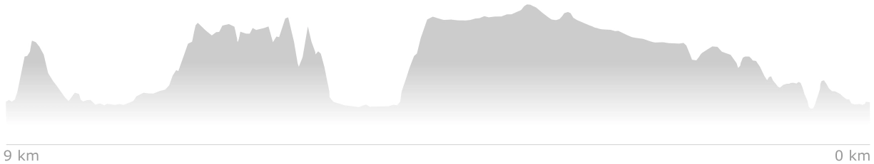
Zavial Beach Trail Map & Topographic Profile
Your Hiking Guide to the Zavial Beach Trail
The Zavial Beach Trail is an intimate but demanding coastal route. Part of the Fishermen’s Trail, it follows tracks historically used by local fishermen to access prime fishing spots and secluded beaches. This section is renowned as one of the most challenging. Its significant gradients, energy-sapping terrain, and overall ruggedness contribute to this reputation.
These features demand self-sufficiency and careful preparation. At Zavial Beach, this trail also links up with the adjacent Furnas Trail, which offers a shorter, circular route for visitors looking to enjoy the scenery more swiftly.
Distance, Duration, and Difficulty
The approximate length of the Zavial Beach Trail is 9 km. Allow 3 to 5 hours for this segment (one way), though this can vary. The trail is rated ‘Difficult’. Expect numerous steep ascents and descents. For instance, the Praia do Zavial path has tricky sections over loose rocks or slick surfaces, as do approaches to Praia do Barranco.
The trail attains its maximum altitude of 56 meters (around 184 feet) when approaching Praia do Barranco from the east. It features a total elevation gain of 260 meters, with maximum and average gradients of 44% and 6%, respectively.
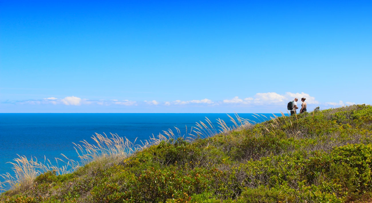
Reasonably fit, prepared hikers will manage. Between Martinhal and Barranco, the trail diverts inland through fields before returning to the coast. Expect rapid environmental changes over short distances.
Zavial Beach Trail | Waymarking and Navigation
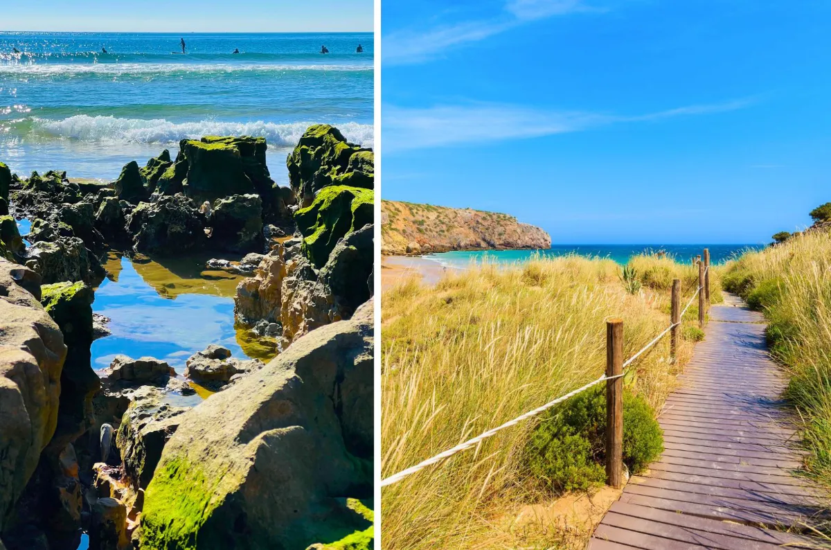
- Waymarking: The trail is marked with distinctive blue and green stripes, typically painted on trees, rocks, and wooden poles (see below). Rota Vicentina signage is generally intuitive, but signs can occasionally be hard to locate. Using a smartphone app for reliable navigation is advisable. A physical or backup digital map is also prudent.
- Preferred Direction of Travel: For the Zavial Beach Trail, hiking from Zavial to Martinhal (East to West) is generally recommended. Primary advantages include better morning sun for photography and superior logistics & facilities at Martinhal post-hike. Despite challenging early sections near Zavial, the smoother exit strategy makes this direction practical for a day hike.
Praia do Zavial Access | The Eastern Trailhead
- By Car: Access is straightforward. A free, dusty parking area is near the beach but can be full in peak season. Arrive early (preferably before 8 AM) to secure parking. Street parking nearby is an alternative. A good tarmacked road from Raposeira (5-min drive) leads to the beach. A two-car shuttle (leaving one at the finish) allows a comfortable return without hiking back.
- Buses, Taxis & Ride-Sharing: Reaching Zavial by public transport is indirect, requiring a bus then taxi. Take a bus to Vila do Bispo, then a taxi to Zavial. Bolt may operate in Zavial; check app availability or pre-book, as service varies rurally. Taxis from Sagres (approx. 15km, 15 min), Vila do Bispo, or Raposeira (5 min) are more certain. Pre-booking local taxis is advisable. Confirm taxi fares beforehand with the driver.
Praia do Martinhal Access | The Western Trailhead
- By Car: Praia do Martinhal is easily reached by car, being situated near the town of Sagres. A substantial free parking lot with space for over 100 vehicles is located adjacent to this beach. Overflow parking is also available along the street (Rua do Martinhal). Still, to secure a free spot during high season, arriving before 8 AM is highly recommended.
- Buses, Taxis & Ride-Sharing: Buses from Lagos stop in Sagres (at the Tourist Office, for instance). From Sagres, Martinhal is walkable (approx. 3km, 33 min) or a short taxi ride. Check official bus operator website for timetables. Bolt/Uber are more readily available in Sagres than Zavial. A taxi from Sagres center to Martinhal is quick (approx. 3.5km, 5 min).
Tour Operators: Tour operators typically offer packages for longer Fishermen’s Trail sections, not just this segment of the Zavial Beach Trail. Packages often include luggage transfers and transport for multi-day treks. Consider this for longer walking holidays incorporating this segment.
Beaches Along the Route | Facilities and Other Relevant Information
- Praia do Zavial: This Blue Flag beach is part of the Rota Vicentina trail network. A beachside restaurant serves fresh fish, traditional Portuguese cuisine, and other options. Basic amenities include toilets and sunbed rentals but not public showers. Lifeguards on duty in summer. Its powerful waves may not suit children or inexperienced swimmers.
- Praia da Ingrina: A sheltered, white-sand cove with calm waters, rocky outcrops, and some palm shade. Ingrina (approx. 2.5km from Zavial along this trail) is good for a break or water refill. A restaurant behind the beach offers seafood and pleasant views. Restaurant toilets, showers, and sunbed rentals available. Ingrina is also a Blue Flag beach with summer lifeguards. A beach kiosk offers kayaking and paddleboarding. Adjacent free parking lots fill quickly. Excellent for swimming (late spring to early autumn), children, and surf beginners.
- Praia do Barranco: A stark contrast, this isolated paradise attracts fishermen, campers, and naturists. It is encircled by unspoiled valleys, hills, cliffs, and dunes. Access via a rough, unpaved road limits crowds. Praia do Barranco has no facilities (no lifeguards, toilets, rentals, bar/restaurant). Informal parking available. Be self-sufficient here. Summer waters are often calm and clear but can be cold. Critically, no lifeguards means swimming is at your own risk; exercise extreme caution.
- Praia do Martinhal: A serene, family-friendly beach with golden sands in a sheltered bay ensuring gentle waters. Naturally protected from strong winds, it’s perfect for swimming and paddleboarding (Blue Flag status). Proximity to a resort ensures good amenities and upkeep. The bay offers spectacular sunset views. Extensive facilities include restrooms, outdoor showers, and umbrella/watersport rentals. It has seasonal lifeguards, picnic areas, and playgrounds. Good accessibility (walkways, restrooms, resort’s amphibious chairs). Free and paid parking. Calm waters and gentle seabed slope make it very safe for children.
Security Considerations on the Zavial Beach Trail
- Cliff Exposure & Vertigo: The trail often runs along cliff edges and it is not recommended for those with severe vertigo or fear of heights. Most people will do just fine. But stay on marked paths and keep a safe distance from edges.
- Trail Conditions After Rain: After heavy rain, paths can be flooded, muddy, and slippery. Rota Vicentina may issue warnings or suggest alternatives then. Don’t forget to check reliable weather forecasts beforehand.
- Emergency Preparedness: Portugal’s universal emergency number is 112. To report environmental harm, call 808 200 520. If hiking alone, inform someone of your route and expected return time. Carry a fully charged mobile phone; note coverage can be patchy in remote sections. Unreliable service makes pre-notifying a contact (if solo) even more important.
- Cliff Stability and Path Adherence: Coastal cliffs are brittle and subject to ongoing erosion. Always stay on marked trails and avoid cliff edges. No shortcuts or new paths: this damages sensitive vegetation. The Zavial Beach Trail is not recommended for young children. Suitable only for older, experienced hiking children/teens with good stamina and discipline.
- Hiking with Dogs: Dogs are permitted but keep them leashed (often a Natural Park rule). Leashing protects fragile vegetation, wildlife, and prevents issues with livestock or local dogs. However, narrow paths can be difficult or dangerous with a leashed dog. Supervised beaches prohibit dogs (especially between May and October). Barranco is an exception due to its unsupervised nature. Still, we do not recommend bringing dogs to this trail.
- No Fires or Wild Camping: Wild camping is not permitted on Rota Vicentina trails or in the Natural Park. Use designated campsites or registered accommodation for overnight stays. Lighting fires is strictly prohibited. Exercise extreme caution with cigarettes, as summer smoking bans in forests and scrubland can occur.
What to Pack and Wear | Zavial Beach Trail
- Footwear, Clothes & Accessories: Appropriate footwear is critical for the Zavial Beach Trail. Well-worn hiking boots or sturdy hiking shoes are essential for support. Trail running shoes are also viable. Ensure footwear is well broken-in to prevent blisters. Sandals, flip-flops, or casual shoes are unsuitable. Dress in layers to adapt to changing conditions. Choose quick-drying, breathable fabrics; avoid cotton (dries slowly, can chill). In winter, prepare for rain and wind chill. A wide-brimmed hat is vital for summer sun protection.
- Sun Protection: High SPF sunscreen, UV-protection sunglasses, and SPF lip balm are essential. Significant sun exposure occurs year-round due to little shade. Be prepared for intense sun and strong winds, even on the same day.
- Cash, Water & Food: Carry ample water (min. 1.5-2L per person, more in heat). Refill at restaurants in Zavial, Ingrina, and Martinhal. Barranco has no drinkable water. Also pack high-energy snacks (nuts, dried fruit, energy bars). A packed lunch is necessary if not eating at beach restaurants. Carry cash for restaurants/taxis; cards may not be accepted everywhere and ATMs are scarce outside towns.
- First-Aid Kit & Other Gear: Include plasters, insect repellent, blister plasters, antiseptic wipes, pain relievers, and personal medications in your first-aid kit. Trekking poles are highly advisable for stability and reducing knee impact on sandy, steep, uneven sections. Pack swimwear and a quick-dry towel for beach dips. Carry a rubbish bag (Leave No Trace). Camera/binoculars are recommended for scenery and wildlife.
Timing Your Trek | Seasons, Weather, and Fitness
- Spring (April-May): Excellent. Typically warm and sunny; coastal landscape vibrant with wildflowers. Lush vegetation post-winter rains; good for birdwatching (migratory species).
- Autumn (late September-October): Highly recommended. Pleasant temperatures, sunny conditions, fewer crowds than peak summer. The sea may still be warm enough for enjoyable swimming.
- Winter (November-March): Pleasant if weather is fair. Wettest months; prepare for rain and strong winds. Daylight hours are shorter. Some beach bars/restaurants may be closed or have limited winter hours.
- Optimal Time of Day: Start early morning, especially in warmer seasons (late spring, early autumn). Enjoy cooler morning temperatures. Provides more daylight for flexibility and a relaxed pace.
- Fitness Level Required: Good hiking-specific fitness is required for the Zavial Beach Trail. Unsuitable for hiking novices or those with significant mobility issues, unless very experienced and prepared.
Other Outdoor Pursuits Along the Trail
- Surfing: The Algarve’s western coast is a renowned surfing destination. Nearby Tonel and Beliche are also famous surf spots. Martinhal’s calmer waters suit surf learners (outside summer peak).
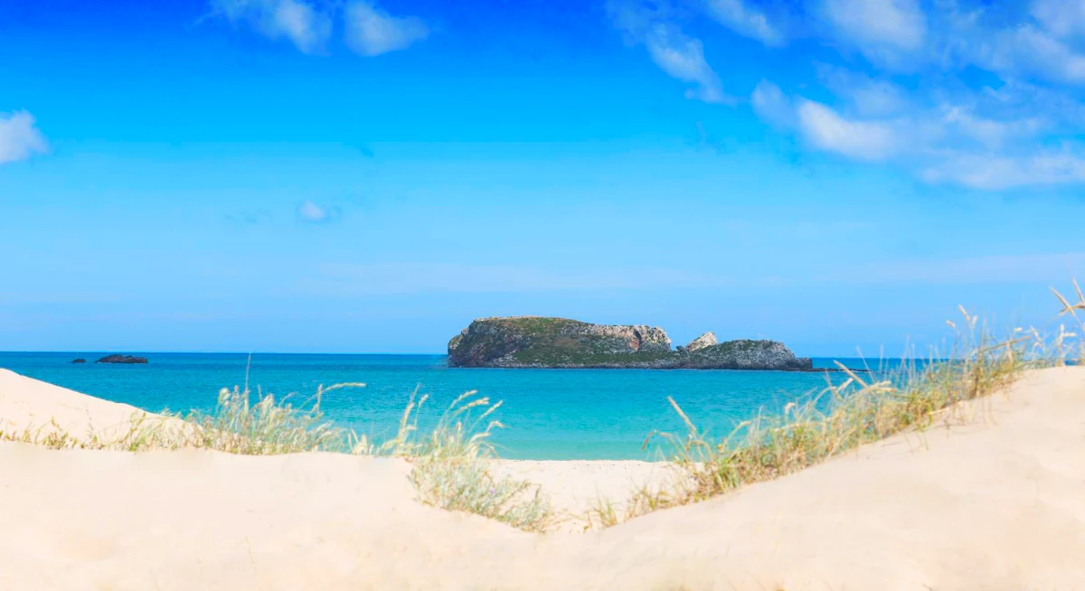
- Snorkeling & Diving: Martinhal’s clear, sheltered waters and limestone islets are popular for diving/snorkeling. Nearby Baleeira Islets offer more diving with diverse marine life. Ingrina’s calm waters also suit snorkeling.
- Kayaking & Paddleboarding: Available at Ingrina (kiosk rentals). Martinhal’s calm bay is also ideal. Sagres boat tours explore coastal grottoes/rock formations.
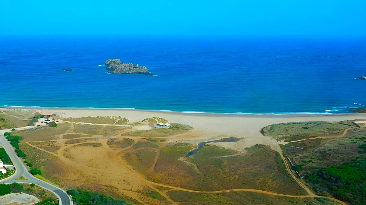
- Birdwatching: Martinhal Lagoon is excellent for birdwatching (spring/autumn migrations). Species like Blue Rock Thrush, Kentish Plover, Whimbrel, and Red-billed Chough may be seen (image below). This seasonal lagoon (dry in summer, fills in wetter season) supports unique flora/fauna (shown below, on the foreground, in the dry season). The entire Natural Park is rich in birdlife; Sagres hosts an October birdwatching festival.
- Roman Occupation Vestiges: Between Martinhal and Rebolinhos, Roman remnants (3rd-5th C. AD) indicate significant presence. Discoveries include a cistern, amphorae furnaces, and a tile/brick kiln. Believed to be a large pottery center for amphorae (transporting salted fish/sauces).
- Dinosaur Footprints: Nearby, in Salema (not on trail): dinosaur footprints approx. 200m west of Salema beach parking (see map). Well-preserved tracks, approx. 250 million years old. Likely from an Iguanodon (up to 12m long). However, visible fossils of beautiful fossilized plants can also be found along the Zavial Trail (as shown in an image above, bottom right). Enjoy and all the very best!