This hike on the Odeceixe Beach Trail is far from a simple stroll. On a spring morning, the charismatic seascape opening before your eyes brings a sublime feeling, connecting you to your roots in the natural world.
TRAIL FACTSHEET
- Location: Coastline between Praia de Odeceixe and Baía dos Tiros | Odeceixe.
- GPS Coordinates: 37.44086656694692, -8.798130448652714 (start); 37.41969799475057, -8.80702602454133 (finish).
- Grade: Somewhat Difficult. This hike is not suitable for young children or individuals with significant mobility issues.
- Type: Linear trail (out and back). Signs mark this trail.
- Length: 6.4 kilometers / 3.98 miles (out and back, total).
- Average Completion Time: up to 3 hours (out & back).
- Best Time to Visit: All year round, except in very hot weather. We do not advise hiking on stormy or very windy days.
- Activities: Nature walks and hikes; birdwatching.

[Note: To get straight to the hiking advice, skip this section.]
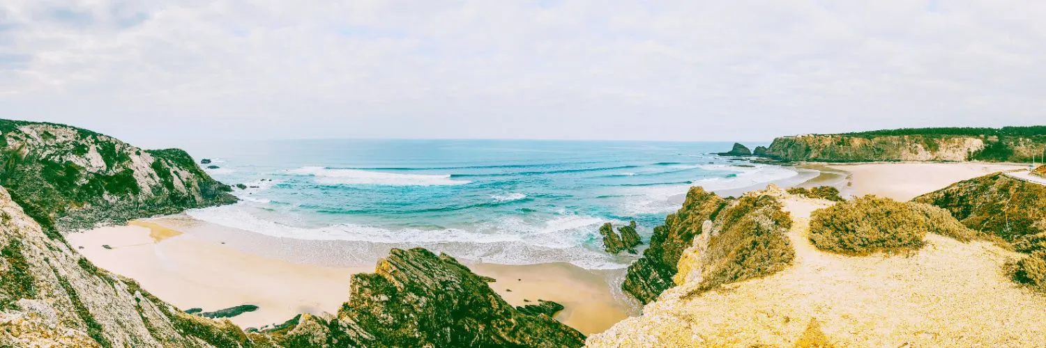
This is a short but intense journey along a coast of geological paradoxes and bold botanical rarities. In this untamed corner of Europe, reality also seems a bit eccentric: here, sand rests not by the sea on a beach, but atop towering, dark, layered cliffs.
And the great Storks, birds usually found on vast plains and church towers, nest on sea stacks battered by waves and storms. Their chicks grow accustomed to the powerful roar of the Atlantic from birth. This is Portugal’s Vicentine Coast—a shoreline forged in deep time and home to natural wonders found nowhere else on Earth.

A Coast Forged in Primordial Fire
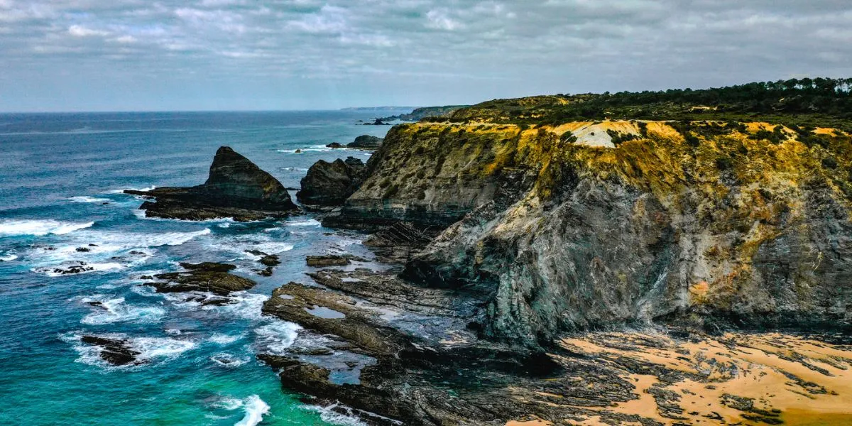
To hike the Odeceixe Beach Trail is to tread on the back of an ancient geological beast. The cliffs that plunge into the deep blue sea are not golden or gently curved like those in the southern Algarve.
Instead, these are formidable fortresses of dark schist and greywacke, like blades pointing to the sky. Their story began over 300 million years ago during the Carboniferous, a period when giant dragonflies ruled the skies. Back then, this was a deep ocean basin where underwater avalanches layered sand and mud onto the seafloor.
These layers were later caught in the colossal compression of the Variscan orogeny. This event crushed and cooked the sediments, transforming them into the hard, stratified rocks we see today.
The relentless Atlantic has spent countless millennia exploiting every fault, weakness, and ancient fold. It has carved the coast into a serrated line of vertical walls, hidden coves, and jagged headlands. This isn’t a landscape of gentle erosion. It is a masterpiece forged in the violence of winds and waves.
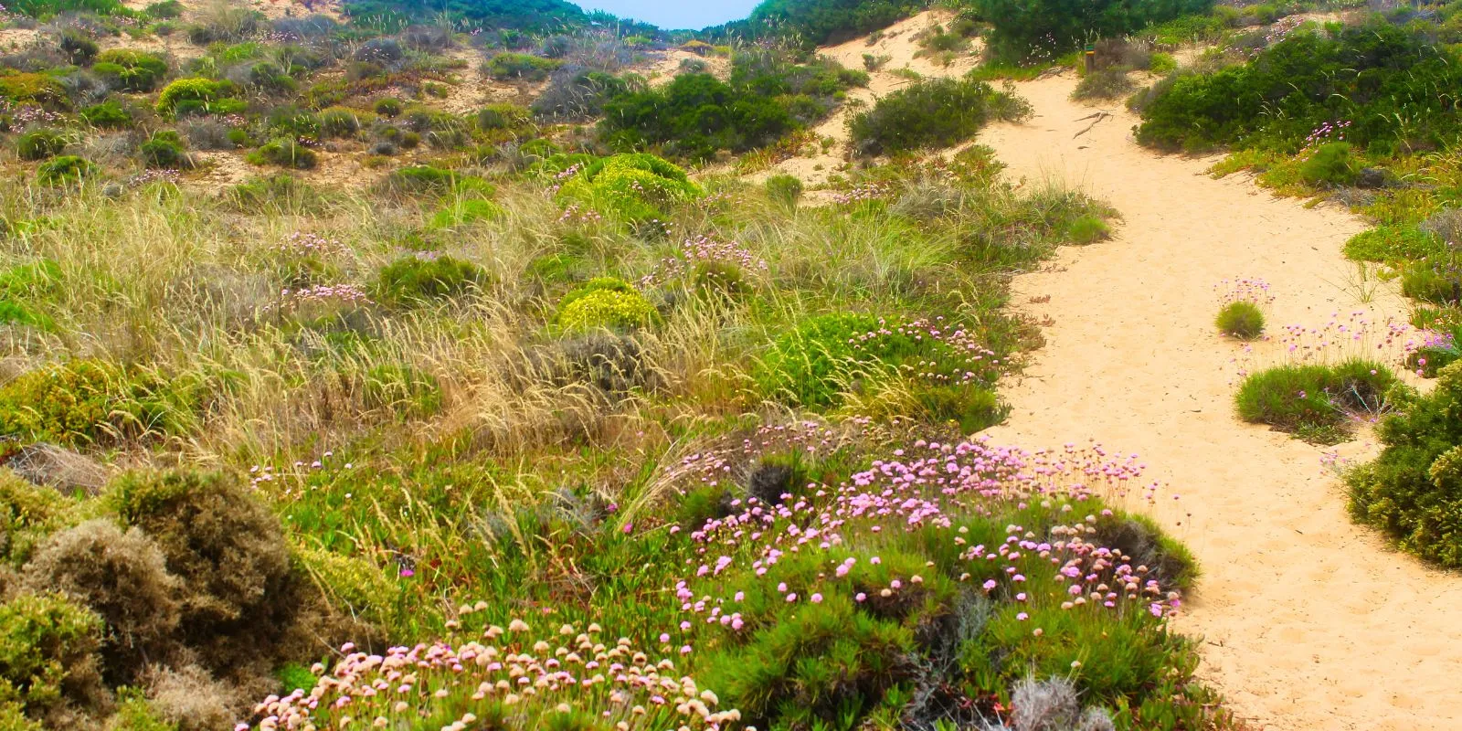
The Enigma of the Clifftop Sands
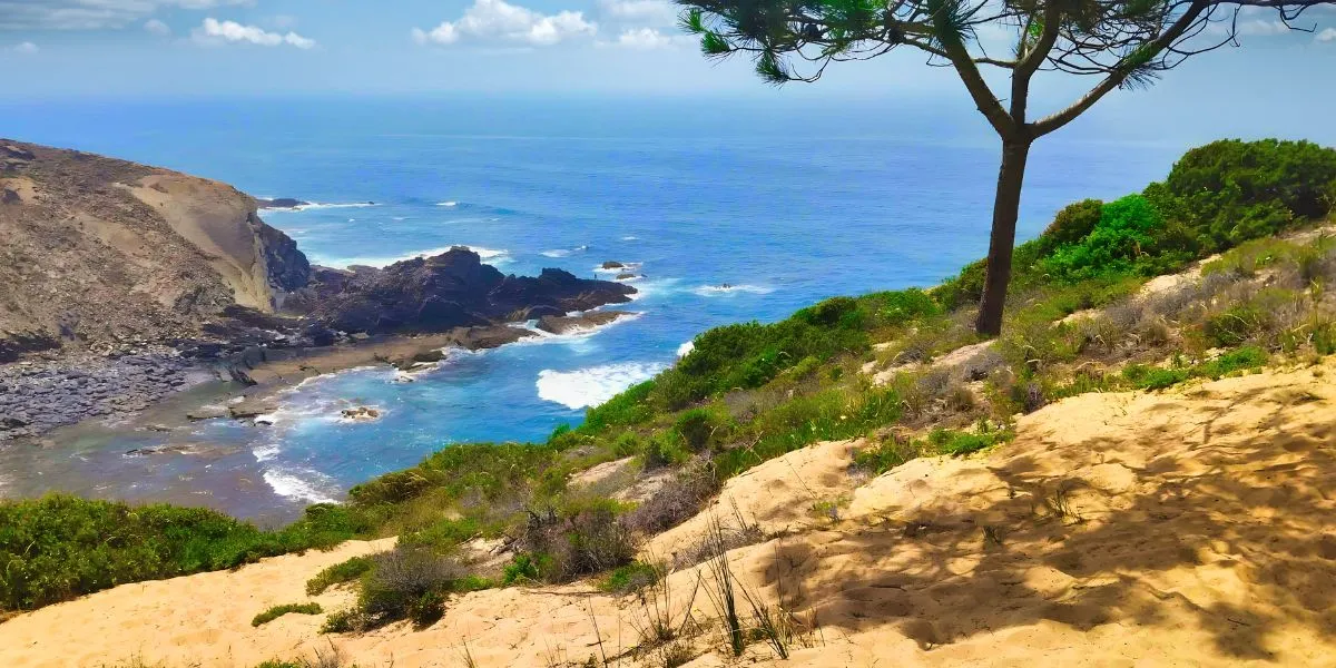
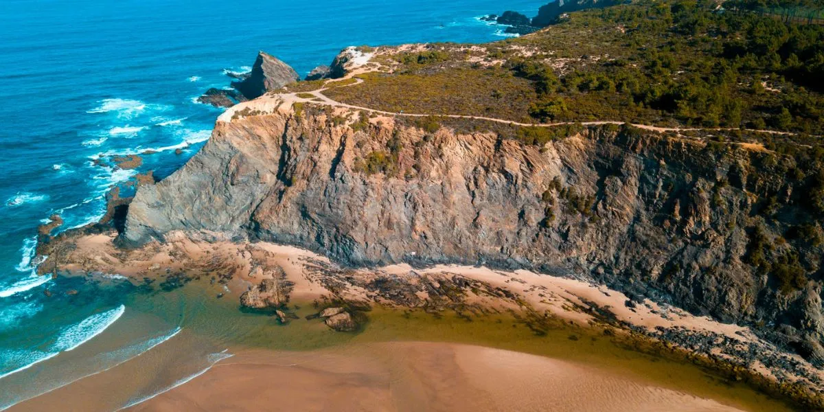
Perhaps the most surreal feature of the Odeceixe Beach Trail is the ground beneath your feet. As you climb to the clifftops, you will leave the rock behind. Gradually, you will find yourself walking on deep, soft sand. The effort is rewarded with views of irrepressible beauty. But how did so much sand get on top of the cliffs? Shouldn’t it be down by the sea?
This seemingly impossible landscape was formed during the Ice Ages. In the Pleistocene epoch, vast amounts of Earth’s water were locked in glaciers, and sea levels were dramatically lower. With less water in the ocean, the ancient beaches stretched for miles out to sea.
For thousands of years, strong winds blew sand from these beaches, creating enormous inland dune fields. As the ice melted and sea levels rose, the ocean carved through these ancient dunes, creating the cliffs we see today. But the sand was left stranded, perched high above the ocean.
What remains is this astonishing sight: fossil dunes crowning coastal precipices. Yes, the correct term is ‘fossil dunes’—a vast, undulating blanket of ancient sand telling the story of a long-lost coastal plain.
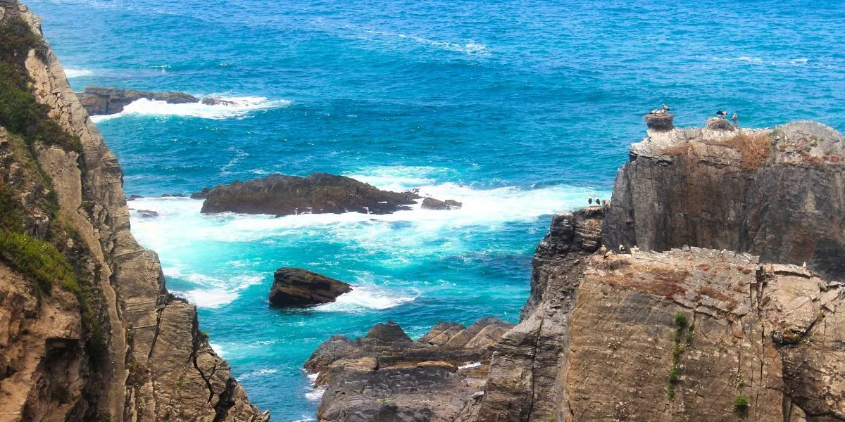
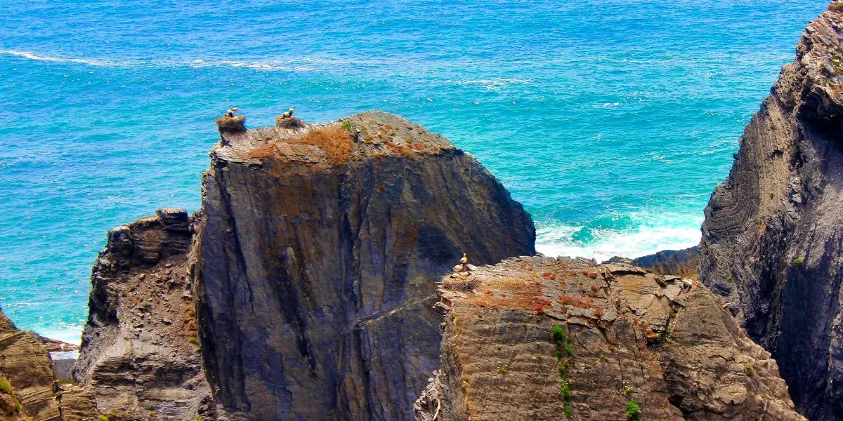
The World’s Only Sea-Nesting Storks
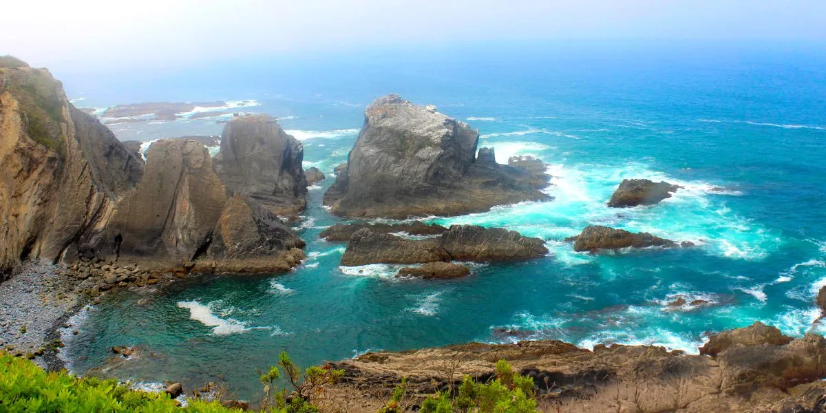
On this unusual geological stage, some animals also behave unusually. The sea stacks and rocky ledges of the Vicentine Coast are the only place on the planet where the majestic White Stork nests on a maritime coast (image above). Look out at the isolated rock pillars standing against the surf. Sooner or later, you will spot their huge, shaggy nests balanced precariously on rocky peaks.
This extraordinary behaviour is a lesson in adaptation. The Storks were likely forced from traditional inland sites by a lack of suitable trees and wily predators like Foxes. So, they turned to the sea. The steep, inaccessible cliffs offer an impassable defence for their vulnerable chicks. Here, they endure strong winds and corrosive salt spray in a daily battle against the elements. Watching them soar on the sea breeze is to witness Darwin’s theory in action. It is a moving sight that defines the wild heart of this trail.
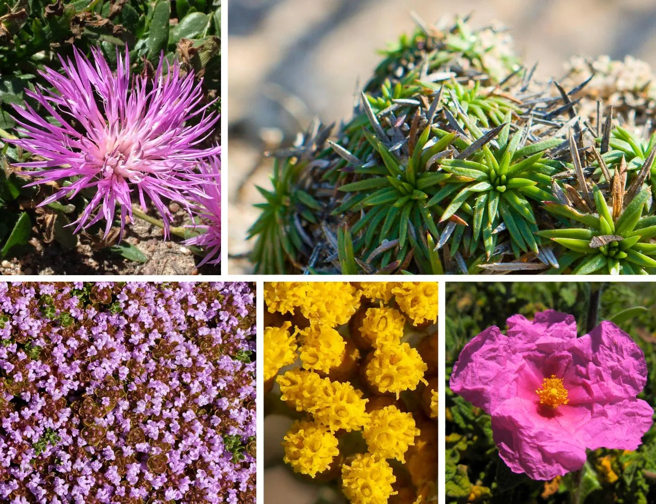
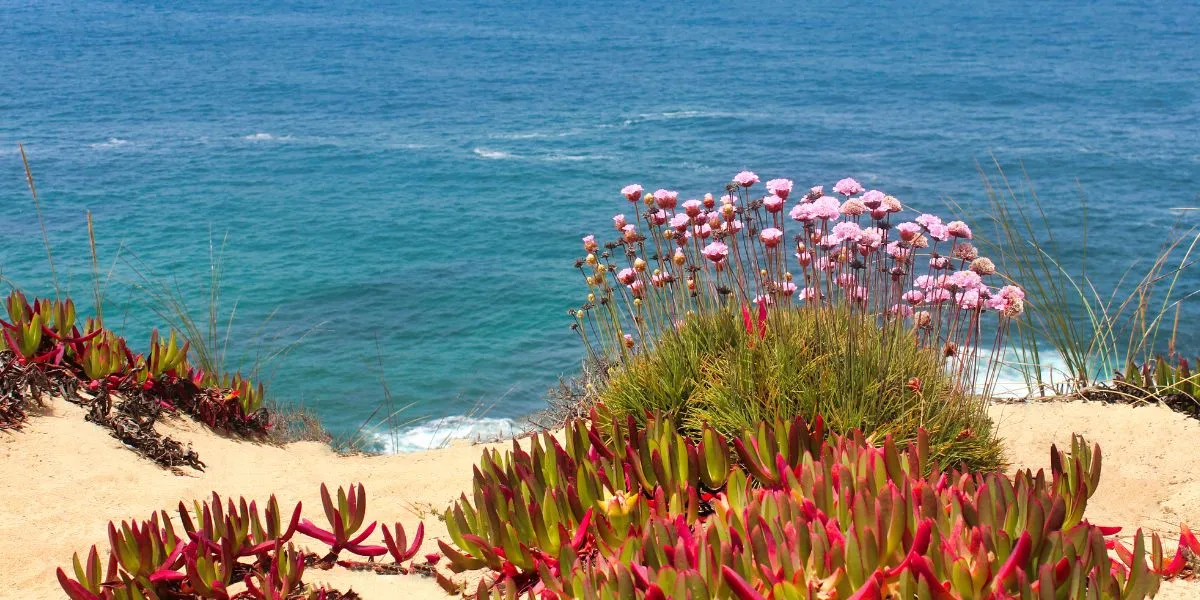
A Botanical Crown with Resilient Jewels
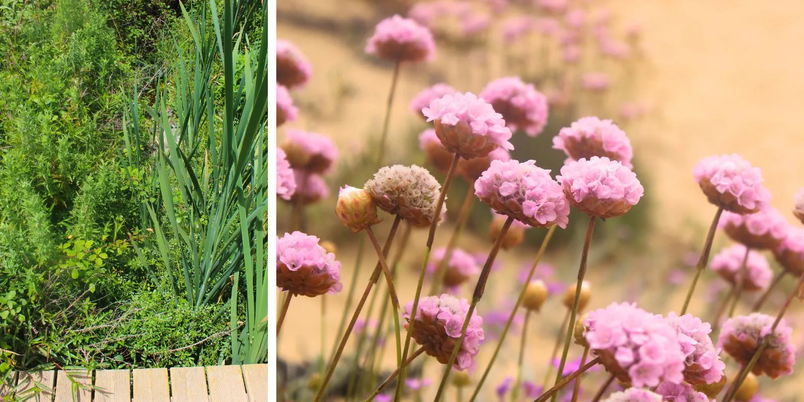
Crowning the cliffs, you’ll encounter a marvellous natural garden. Here, the clifftop dunes and scrublands are exposed to salt, wind, and relentless sun. But this hostile environment has given rise to a unique botanical treasure. As you walk the trail, the air is thick with the scent of aromatic herbs. This is the realm of endemic plants found nowhere else in the world.
Look for the delicate Vicentine Centaurea (Centaurea vicentina), a local knapweed, and the incredibly rare Plantago almogravensis, a plantain once thought to be extinct. Accompanying them are the sturdy textures of Camphor Thyme, the yellow blooms of the Curry Plant, and the papery flowers of Pink Rockroses (image below, clockwise, courtesy of Flora-On). In spring, the trail becomes an expression of colour and fragrance. Designed by adversity, this greenery commands the full attention of your nose and eyes.
The Human Trail | Danger and Reward
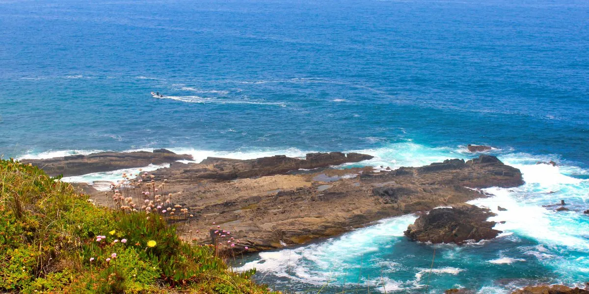
But be prepared: this beauty doesn’t come easily. It is conquered with sweat. The same sand that makes the landscape so unique also makes the hike a challenge. In many sections, the sand is ankle-deep. Progress is strenuous but also strangely meditative. Bringing plenty of water is not a suggestion; it’s a necessity under the unforgiving sun. However, every demanding turn reveals another stunning panorama of hidden rocky beaches or brooding geological formations.
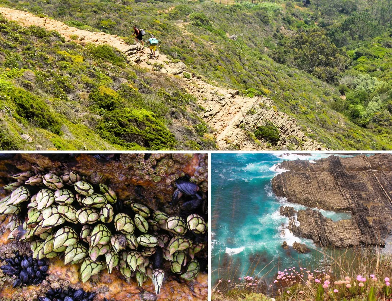
Here and there, you will likely see the local fishermen who first blazed these trails. Below is an image of two of them climbing out of Tiros Bay. The narrow tracks surrounding you—including the Odeceixe Beach Trail—were etched into the landscape over centuries by these fishermen. In addition to fish, they harvest prized gooseneck barnacles (below, on the left). This is a dangerous tradition that requires fishermen to place themselves right between sharp rocks and the powerful Atlantic surf, a practice that underlines the intimate bond between the sea and the people of this coast.
A Hike of Sensory Contrasts
This walk on the Odeceixe Beach Trail is an immersion in another landscape and another time. It’s about feeling the wind on your skin and the taste of salt on your lips. It’s about the unique botanical scent that permeates the air. It’s a journey of contrasts: the dark cliffs against the golden sand, the majestic birds battling the ocean for their young, and a coastline that defies expectations. Enjoy the hike!
Hiking the Odeceixe Beach Trail: An FAQ Guide
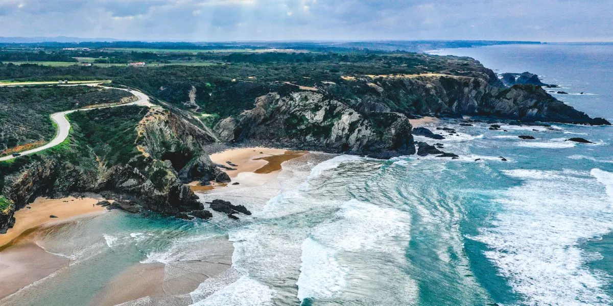
Where the Alentejo’s rolling plains meet the Algarve’s sun-kissed shores, a dramatic transformation occurs. The land fractures into towering cliffs of ancient schist, plunging into the deep blue of the Atlantic. This is the Costa Vicentina, one of Europe’s last great wild coastlines, and your journey begins here, at the breathtaking Praia de Odeceixe.
This guide provides answers to the most frequently asked questions for hikers wishing to explore this segment of the Fishermen’s Trail, ensuring a safe, responsible, and unforgettable adventure.
Odeceixe Beach Trail Map
Q: How Difficult is the Odeceixe Beach Trail?
A: The trail is rated “somewhat difficult” primarily because of the physical effort required to walk on long sections of soft sand, not due to steep climbs.
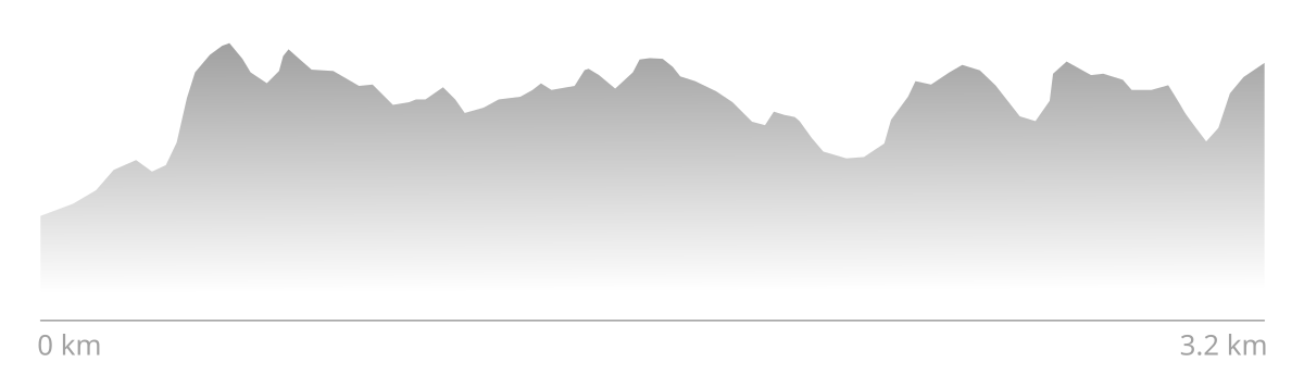
This difficulty stems from the fact that progressing through deep, soft sand demands more energy and muscular effort than walking on a firm surface. This slows your pace, increases fatigue, and places greater strain on your legs. When this sustained effort is combined with the trail’s constant exposure to sun and wind, the challenge becomes clear. The trail’s highest point reaches approximately 52 meters (171 feet) above sea level. Here is the trail’s elevation profile (one way, north to south):
Q: Is the Odeceixe Beach Trail Safe to Hike Alone?
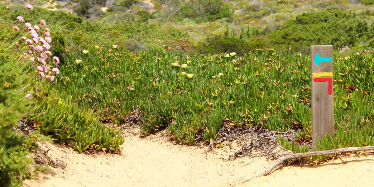
A: While the trail is well-marked, solo hiking requires extra precaution due to unstable cliff edges, patchy mobile phone service, and the strenuous nature of the hike. It is officially not recommended for those with vertigo or a fear of heights.
Your safety on this trail depends on a keen awareness of the natural environment. Always inform someone of your route and estimated return time. It is absolutely imperative to stay on the well-marked trail at all times and maintain a safe distance from the cliff edges, which can crumble and collapse without warning. Navigation is straightforward thanks to the Fishermen’s Trail’s distinctive stripes (image above). In case of an emergency, the national emergency number is 112.
Q: How Long is the Odeceixe Beach Trail and How Much Time Does it Take?
A: The main day hike to Tiros Bay is a linear, out-and-back route of approximately 6.4 km (3.98 miles) round-trip. A longer option to the next beach, Praia da Barradinha, makes for a roughly 8 km (5 miles) round-trip.
The trek from Odeceixe Beach south to Tiros Bay is the very beginning of the much longer 23 km Odeceixe to Aljezur stage of the Fishermen’s Trail, which typically requires a full day of about 6 hours to complete. The day hike detailed here covers the most scenically dramatic coastal portion at the start of that longer stage.
Q: When is the Best Time of Year to Hike the Odeceixe Beach Trail?
A: The absolute best time to hike is Spring (April-May) for its spectacular wildflowers and mild weather, followed by Autumn (September-October). Summer is generally not recommended due to extreme heat.
- Spring: This is when the landscape is at its most beautiful. The coastline erupts in a carpet of wildflowers, creating a colourful tapestry. Temperatures are perfectly suited for hiking, and it’s the prime season for observing the famous White Storks nesting on the sea cliffs.
- Autumn: The weather remains pleasantly warm, and the ocean temperature is often at its peak for a post-hike swim. The large crowds of the summer have departed, leading to a more tranquil experience.
- Summer: June through August are generally not recommended. Daily temperatures frequently exceed 30°C (86°F), and the trail’s complete lack of shade makes hiking not just uncomfortable but potentially dangerous.
- Winter: For those who prioritize solitude, Winter (November-March) is a viable option. Daytime temperatures are mild, but waterproof gear is essential.
Q: What is the Best Time of Day to Hike this Trail?
A: It depends on your main objectives. But midday is never recommended.
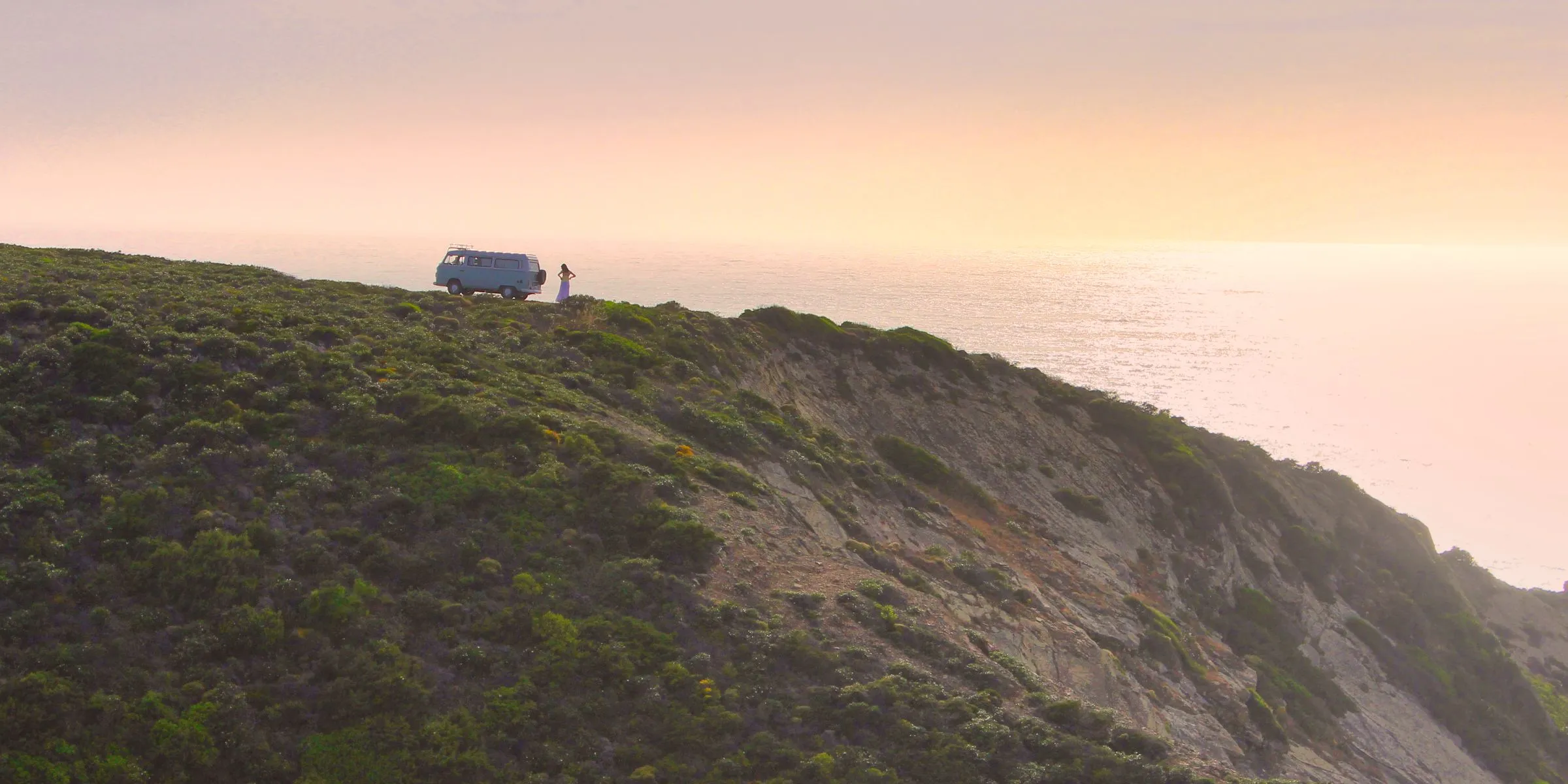
- Morning (Early Start): An early morning start is highly recommended, particularly from late Spring through early Autumn. This strategy allows you to cover the most ground before the intense midday heat sets in. The low-angled morning light is also ideal for photography.
- Afternoon (Late Start): A late afternoon hike can be pleasant in the cooler months of the year. In warmer seasons, this is the hottest part of the day and should be avoided for strenuous activity. The main advantage of a late start is the opportunity to experience the “golden hour” light and sunset on your return journey.
- Photography Considerations: The “golden hours”—the periods shortly after sunrise and before sunset—provide the most dramatic and beautiful light for photography. The low-angled sun casts a warm light on the cliffs, creating long, dramatic shadows that accentuate the landscape’s texture. As the coastline faces west, it is an exceptional location for capturing stunning sunset photographs over the Atlantic Ocean.
Q: What Essential Gear Should I Bring for the Odeceixe Beach Trail?
A: Essential gear includes sturdy hiking shoes, comprehensive sun protection, and at least 2-3 litres of water per person. Lightweight hiking gaiters are also recommended to keep sand out of your boots.
- Footwear: This is your most critical piece of gear. Sturdy, well-broken-in hiking shoes or high-quality trail runners are essential. High-ankle boots have the added advantage of helping to keep sand out.
- Gaiters: This often-overlooked item will prevent sand from getting inside your footwear—a primary cause of blisters and discomfort.
- Clothing: A layering system is important. In winter, start with a moisture-wicking base layer, add a fleece for warmth against the wind, and have a waterproof and windproof outer shell.
- Sun Protection: This is non-negotiable. A wide-brimmed hat, UV-protection sunglasses, and a high-SPF, broad-spectrum sunscreen are mandatory.
- First-Aid Kit: Carry a personal kit with essentials, paying special attention to foot care like blister treatments.
- Other Essentials: Mobile phone, a portable power bank, a headlamp in case of delays, and trekking poles for stability on the sand.
Q: How do I Get to the Odeceixe Beach Trail and Where Can I Park?
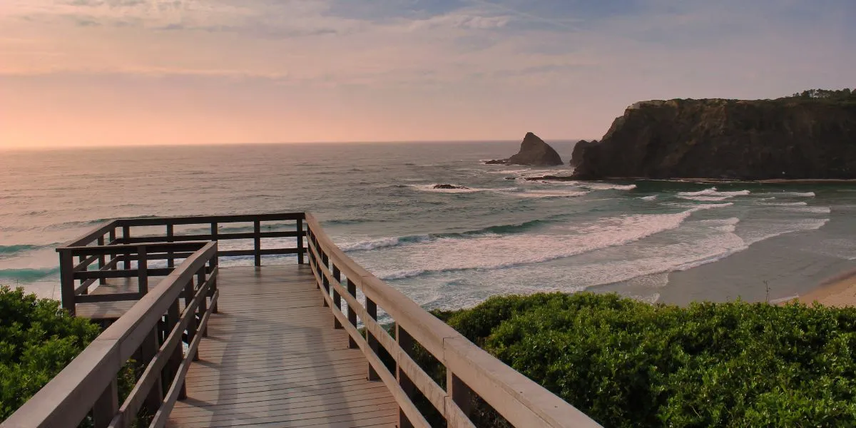
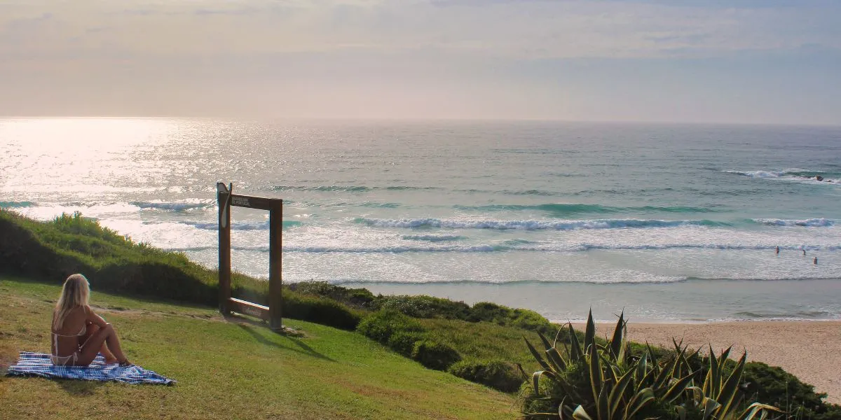
A: The proposed trailhead (image above) is at Praia de Odeceixe, about 3-4 km west of Odeceixe village, and is accessible by car. There is a main parking lot, but arriving early in summer is essential to secure a spot (please check the map).
When driving, approach Odeceixe via the main EN120 road and then follow the signposting for “Praia” (Beach). Parking near the trailhead requires a strategic approach, especially during peak season. There is a dedicated parking lot located close to the beach, which offers both paid and free parking options. Additional parking spaces can be found on the southern cliffs, closer to the start of the southbound trail. If these areas are full, a common practice is to park along the side of the main access road leading down to the beach.
Q: Can I Reach the Odeceixe Beach Trail Using Public Transport?
A: Yes, but it requires planning for the final 3-4 km from Odeceixe village to the trailhead at the beach. Bus services do not go directly to the beach. The largest bus operator within the Algarve is VAMUS.
The main bus services from regional hubs like Lisbon, Lagos, and Aljezur all terminate in Odeceixe village. From there, hikers must account for the additional journey to the coast. This can be done by walking, taking a local taxi, or using the seasonal tourist “road-train” (typically operates June-September, but verify locally). Ride-hailing apps like Uber and Bolt are unreliable here; pre-booked local taxis are a far better option.
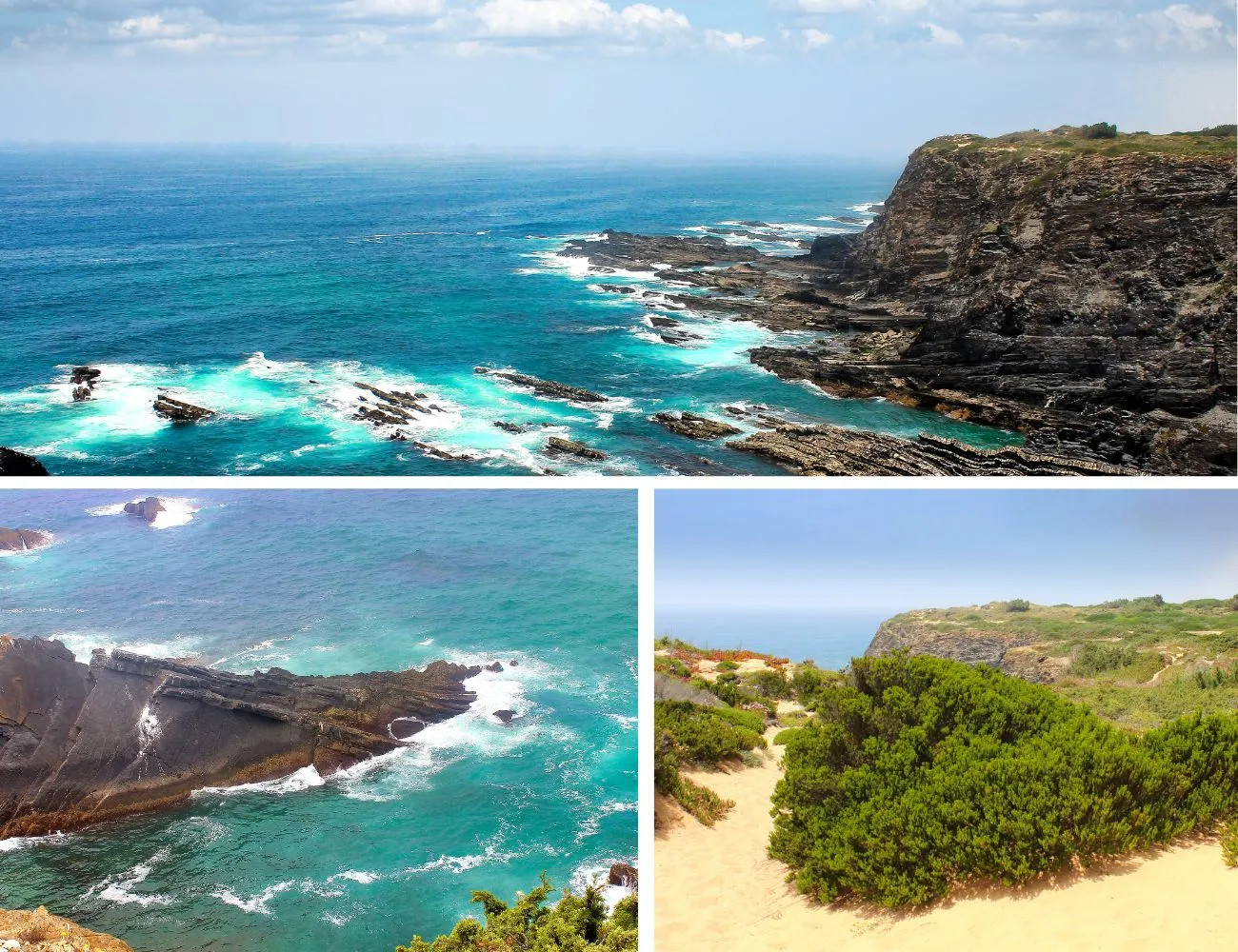
Q: What are the Natural Highlights of the Odeceixe Beach Trail?
A: The trail is an immersive journey through a landscape of unique geology, rare plants, and iconic wildlife. The most famous sights are the dramatic, dark schist cliffs, the fields of spring wildflowers, and the world’s only sea-nesting White Storks.
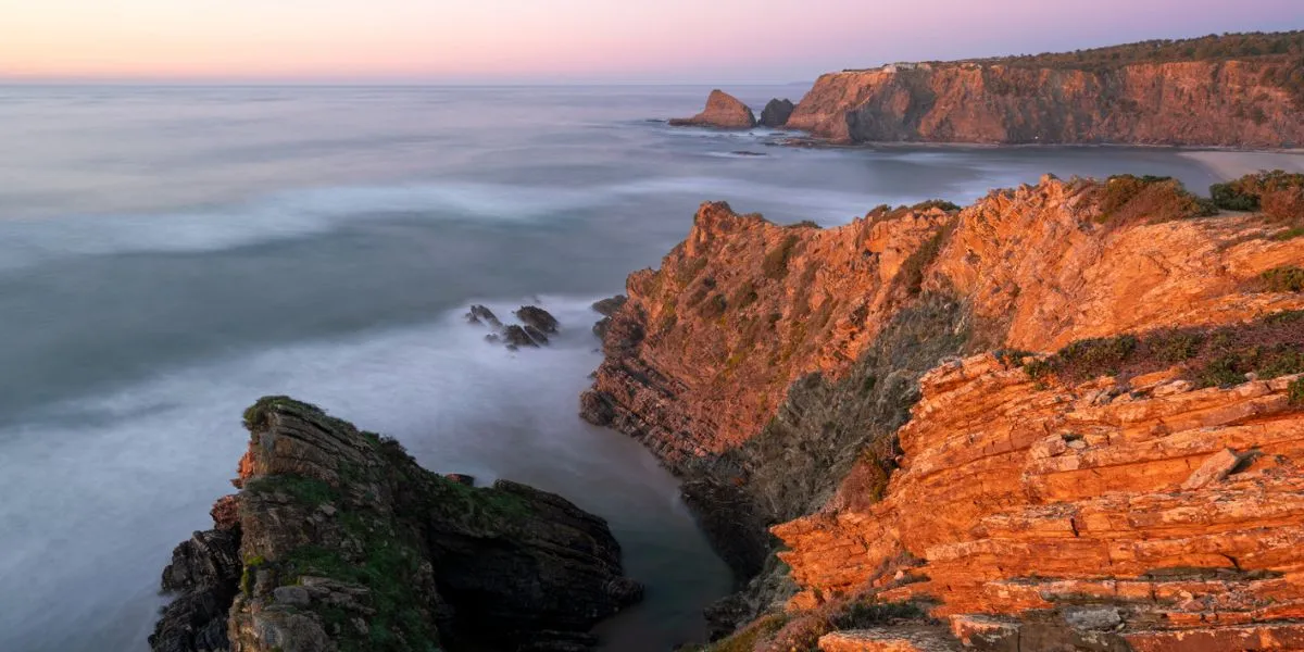
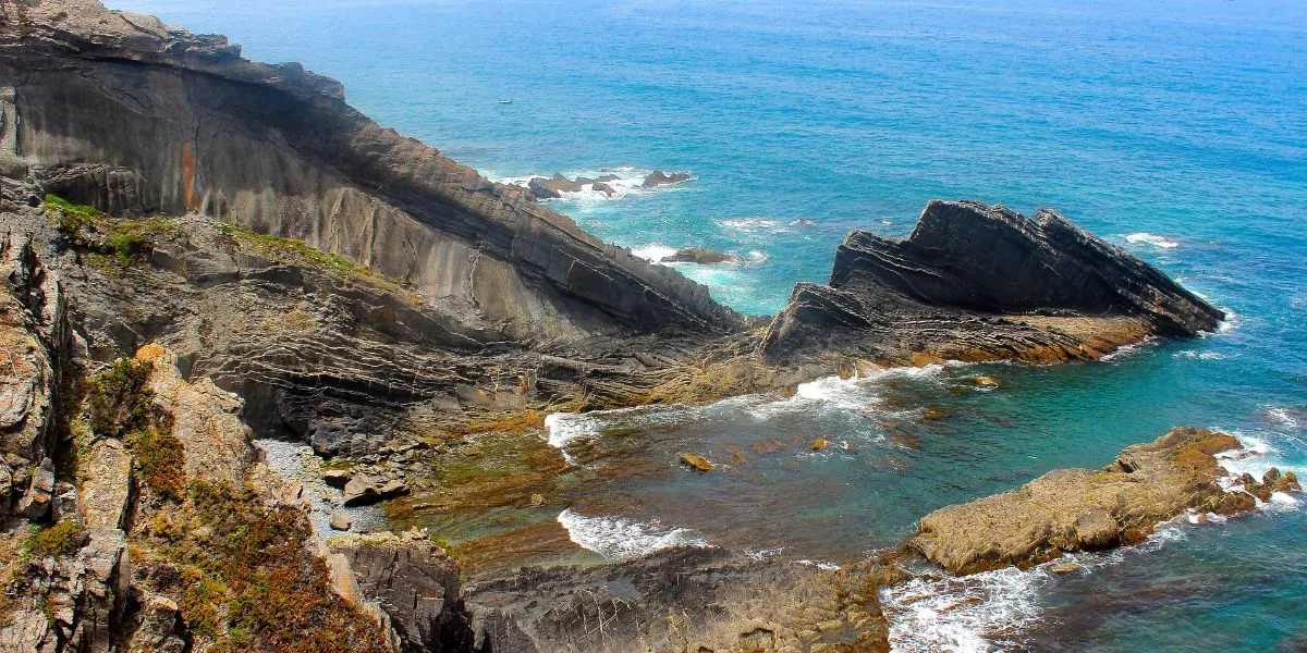
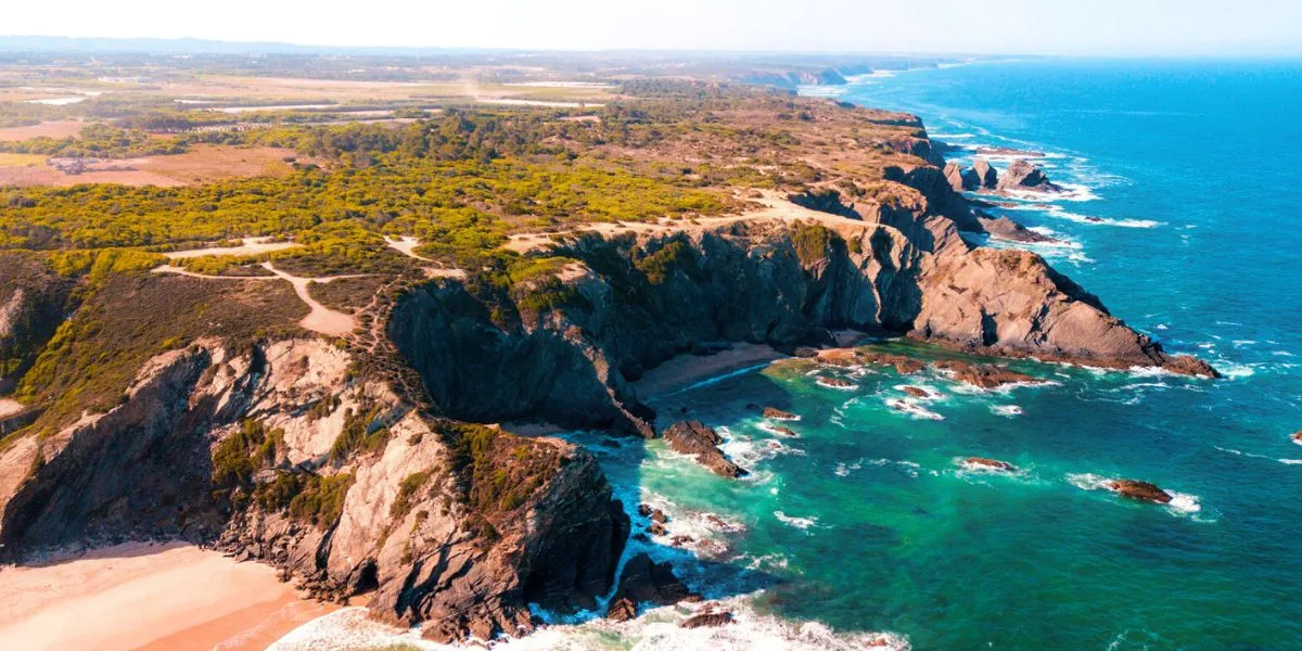
- Geology: The coastline is a spectacular open-air museum. The dramatic cliffs are composed of dark, layered schist and greywacke formed 300 million years ago. These are interspersed with younger marl and limestone from the Mesozoic era, deposited around 150 million years ago when this area was a shallow sea. As you walk, look for the incredible folds and fractures in the rock layers, especially the famous, prominent “Dragon-shaped Cliff” (image above).
- Flora: The Vicentine Coast is a botanical hotspot. Along the sandy path, you will be surrounded by resilient aromatic shrubs. In spring, the cliffs are adorned with countless, fragrant wildflowers.
- Terrestrial Fauna: The most sought-after sightings are the unique cliff-nesting White Storks. Kestrel and Peregrine Falcon are common, but the rare Red-billed Chough also occurs throughout the area. The park is also a vital sanctuary for the rare marine-adapted Eurasian Otter, though they are shy and most active at dawn and dusk. What makes this population extraordinary is its adaptation to a marine environment, as elsewhere they only inhabit freshwater habitats; these otters hunt for fish and crustaceans in the sea and use freshwater streams and dens in the sea cliffs for shelter. Other mammals like the Eurasian Badger and the Egyptian Mongoose also inhabit the area but are even more elusive.
- Marine Life: The Atlantic waters below teem with life. The rocky seabed provides a rich habitat for various species of Sea Bream, European Sea Bass, Octopus, and Cuttlefish. On calm days, it is sometimes possible to spot pods of Dolphins passing further offshore.
Q: Where Can I Find Accommodation and Food Near the Odeceixe Beach Trail?
A: Odeceixe serves as an excellent basecamp, offering a range of services in both the beach area and the main village inland.
At Odeceixe Beach, a small cluster of beachside restaurants and cafés provides the perfect spot for a post-hike meal, though many are seasonal (roughly April to October). The village, 3-4 km away, boasts a more extensive and reliable selection of dining options, accommodation, small markets, a pharmacy, and ATMs. The nearest large supermarket is in Aljezur, a 15-20 minute drive away.
Q: What Else is There to Do in the Area Besides the Odeceixe Beach Trail?
A: Odeceixe offers a wealth of other activities, particularly water sports and exploring the local village and coastline.
- Surfing & Bodyboarding: Odeceixe Beach is a renowned surf spot for all skill levels, with several surf schools offering lessons and rentals.
- Kayaking & Paddleboarding: The calm River Seixe creates a sheltered lagoon on the beach perfect for leisurely paddling.
- Explore Odeceixe Village: Wander the charming, whitewashed streets and walk up to the historic windmill for panoramic views.
- Beach Hopping: Just south of the main beach is Praia das Adegas, a small, sheltered cove that is an officially designated naturist beach.
- Cycling and Bikepacking: The Rota Vicentina also features an extensive network of cycling trails for another fantastic way to explore the park.
- Birdwatching Tours: Given the region’s status as a world-class birding destination, several companies offer guided birdwatching tours. These are often focused on the Sagres Peninsula, a key bottleneck for bird migration. In Autumn, you can see a spectacular diversity of raptors, seabirds, and passerines.
Q: What Are the Main Rules to Follow on the Odeceixe Beach Trail?
A: The rules are in place to protect the fragile natural environment and ensure visitor safety. The most important rule is to stay on the marked trails at all times.
- Stay on the Marked Trails: Do not take shortcuts or create new paths to protect the fragile dune vegetation from erosion.
- Leave No Trace: Pack out everything that you pack in.
- No Wild Camping: Wild camping is strictly prohibited within the Natural Park.
- Do Not Pick Plants or Disturb Rocks: The area’s flora is a protected treasure.
- No Fires: Fires are strictly forbidden due to the very high risk of wildfires.
- Prohibited Activities: Trail running is officially discouraged due to its higher impact on the sandy paths. Driving any vehicle on the dunes is illegal.
Q: Are There Toilets or Water Available on the Odeceixe Beach Trail?
A: No, there are absolutely no toilets, water fountains, or shops on the trail after you leave the restaurants at Praia de Odeceixe. Hikers must be completely self-sufficient.
You must carry all the water and food you will need for the entire hike. Carry a minimum of 2 to 3 litres of water per person. On warmer days (late spring through early autumn), this should be increased to 4 litres. Pack high-energy snacks such as nuts, dried fruit, and energy bars to fuel you throughout the walk.
Q: Can I Bring My Dog on the Odeceixe Beach Trail?
A: Yes, according to the official Rota Vicentina rules, dogs are permitted but must be kept on a leash at all times.
Please be aware that the deep sand and lack of shade can be very challenging for dogs, especially on warm days. Ensure you carry enough water for your pet and are prepared for the strenuous conditions. Enjoy your hike!