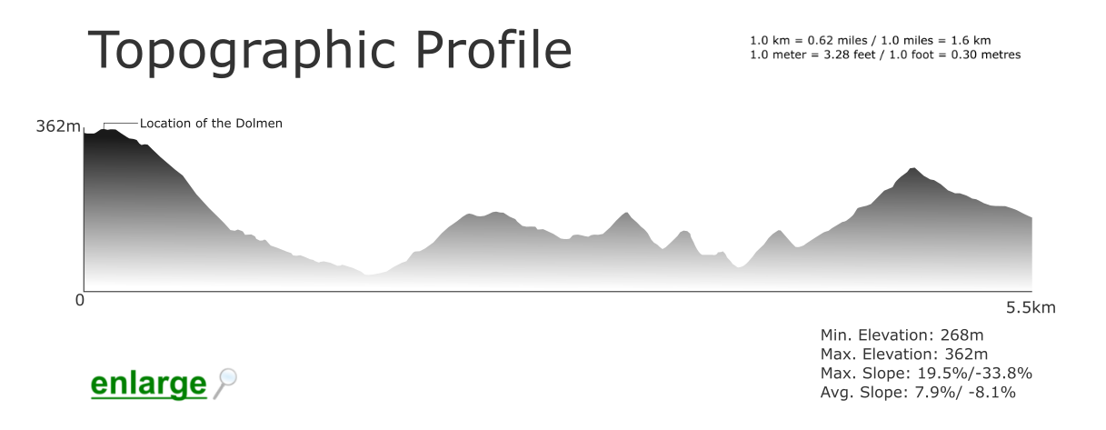
Location: PR8 route, Mealha, Cachopo parish, Tavira municipality; GPS Coordinates : 37º 21′ 48.06” N 7º 52′ 18.40” W; Grade: moderate/medium difficulty; some stretches can be more difficult for elderly or very young visitors; Type: circuit (loop) trail; this trail is signposted; Length: 5500 meters/ 3.42 miles; Average Completion Time: up to 2 hours; Best Time to Visit: Spring and Autumn; not advisable on rainy or very hot days; Activities: nature walks and hikes; birdwatching.
Despite its diminutive size, it is easy to get lost within Mealha because the ‘PR8’ walking route is not clearly signposted (learn more). But this is a simple walk, though. The trail starts in the vicinity of an old elementary school and then meanders through whitewashed houses, cattle pens, agricultural patches and ancient circular buildings made of slate. Topped by conical roofs that resemble witch hats, these circular constructions were built eons ago to store hay for livestock.
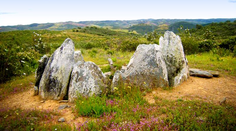
 Next to a copse of holm oaks, the trail then takes you across a shallow river bed before heading up a hill where a Neolithic dolmen is located. This hill, named Masmorra (‘dungeon’) offers great views of the surrounding landscape. Indeed, on clear days, it is possible to appreciate the Alentejo plains to the north and the coast of Castro Marim to the south. With its assortment of myrtle, rockrose, purple phlomis and kermes oak, the landscape’s plant cover is sparse but it is also biologically rich. Olive, almond, mastic, pine and strawberry trees are very abundant as well.
To see the dolmen, at the top of the hill you’ll have to turn towards the ruined windmills. Encircled by fragrant rockroses, you’ll finally find this 3rd millennium BC megalith behind the ruins. These types of Neolithic burial chambers were always placed on high ground so as to be seen from afar and to dissuade unwelcomed visitors with its magical-religious symbolism. By facing east, the dolmen’s axis is aligned to coincide with sunrise during the Summer solstice. After taking in the scenery, head down on the other side of the hill and back into the village.