TRAIL FACTSHEET: BORDEIRA TRAIL | VICENTINE COAST NATURAL PARK
Location: Bordeira – Aljezur Municipality, Western Algarve | Coordinates: 37.198568 N, -8.863443 W (decimal degrees) | Grade: Easy/Moderate (short version); Moderate (long version) | Type: Loop and Out & Back trails; dirt and gravel tracks | Length: Shorter trail: 5000 meters (3.1 miles); Longer trail: 14000 meters (8.7 miles) | Average Completion Time: Up to 2 hours (short trail); up to 5 hours (long trail) | Best Time to Visit: all year-round; especially good in spring for botanical species; avoid the longer trail during very hot days | Activities: birding; nature walks; hiking; cycling & other outdoor activities; sightseeing.
Here, being freelance farmer/freelance hunter-gatherer is not that difficult. The land is naturally fertile, the sea is bountiful, and there’s wild thyme, savory, rosemary, marjoram and oregano growing just about everywhere. Such profusion of culinary herbs is the reason behind the trail’s other name: this is the ‘Trail of Aromas’, and soon you’ll discover why. At first bordered by small plots of farmland, the trail starts on a crossroads near the white-washed village. It soon turns right, crossing a little stream of limpid water where it is possible to observe fish, newts, crayfish, and pond turtles.
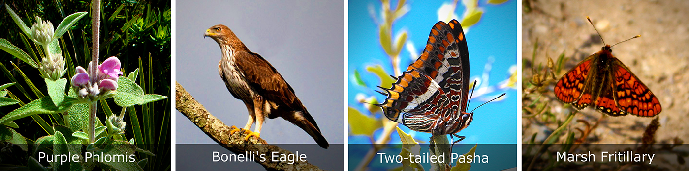
The trail then starts to climb ever more steeply up a hill from which you can contemplate the verdant valley that spreads to the west, towards the dunes of Bordeira Beach. During spring, the surrounding slopes will be peppered with large flowers of Gum Rockroses (see main picture above) and the scent of Eucalyptus will spread through the air; at the top of the hill, look up to the skies and you’ll probably see large birds silhouetted against the blue horizon. This vantage point is a good place to observe Peregrine Falcon, Alpine Swift, White Stork, Buzzard and maybe even the rare Bonelli’s Eagle (if you are lucky enough).
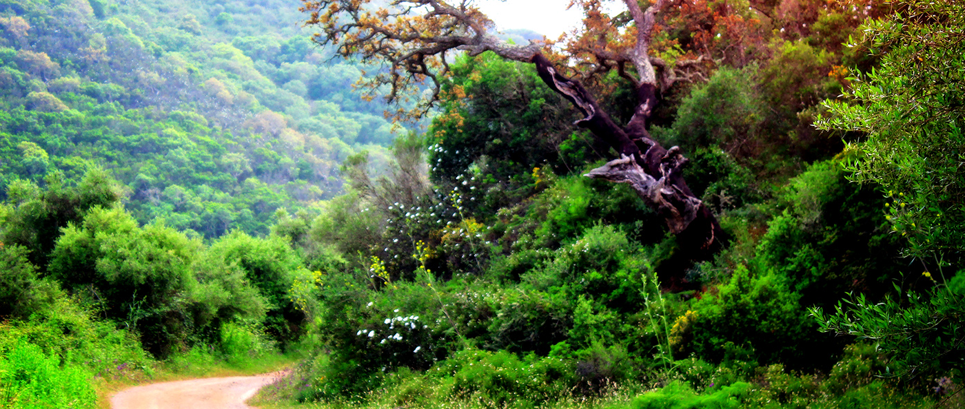
 Make your way down the trail and you’ll find another valley. Bounded by steep gradients on both sides, this narrower valley is a rich alluvial plain covered by a diverse cast of wild plants. Flanking the trail you’ll encounter Grey-leaved Cistus, Sage-leaved Rockrose, Mastic, Honeysuckle, Purple Phlomis and quite large Dog Rose shrubs. Throughout the warm season, this is an excellent area to find beautiful butterflies like the Marsh Fritillary or the Red Admiral, as well as the largest butterfly found in Europe, the Two-tailed Pasha. Creating a suitable habitat for numerous passerines, the valley floor is covered mainly by rushes, sedges and further hydrophyte vegetation. To the left, stretching along the north face of the hill you’ll also see a very healthy gallery forest* composed of two distinct layers: the upper layer is comprised of Cork Oaks, Umbrella Pines and a few Portuguese Oaks, whereas the lower layer is mainly formed of Ash and Alders. With such ecological mosaic, it’s no wonder that the air of this pleasant valley is always filled by melodious birdsongs. Stop for a moment in silence to be handsomely rewarded by the rustling leaves of Alders and the trill of many warblers.
Then the path turns to the left next to a columnar well. Shortly thereafter, you are likely to hear the buzzing sound of honey bees in their hives – placed in the middle of the woods, the beehives are far from view but its location is marked by stately Cork Oaks perched on the slope to the right. In spring, the reason for so many bees becomes apparent a bit later on down the trail: just after the abandoned hamlet, there is a pretty meadow covered by poppies, by daisies, and by a lot other wild flowers. Together with the lavender, the rosemary and the thyme growing on the hills, these spring flowers are a real manna both for the bees and for the local beekeepers.
The trail intersects this meadow before crossing again the small stream that nourishes the lower valley; here, smelling the air feels like opening a jar of honey for the first time. The trail finally returns to its origin by embracing the wooded slope that borders the floodplain. By the end of it, we bet that you’ll also want to become a modern hunter-gatherer. Enjoy!
* A forest restricted to the banks of a river or stream. Also called ‘Riparian Forest’.